Fourth Level Assessment – Aquatic Habitat Rehabilitation Plan
Bank Stabilization
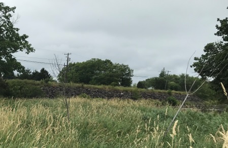
Village of Petitcodiac (2015) N 45.940193 W -65.178198
The first bank stabilization project on the main stem was done by the Petitcodiac Watershed Alliance in 2015 with the assistance of Parish Geomorphic Ltd. and Fort Folly Habitat Recovery. Part of the goal of the activity was protection local infrastructure– specifically Route 106 on the north side of the river. The issue here was a section of Route 106 (roughly 200 years old, what had been the Westmorland Great Road (Goodrich 2010) which in the modern era has been paved and armoured with riprap (Figure 24) and has created a sharp right-angle turn, beyond which it artificially straightens this portion the river, greatly disturbing flow, resulting in bank erosion both above and below Route 106.
On the opposite bank, The Village of Petitcodiac Sewage Lagoon (Figure 25) was also a source of concern- threatened by flooding and erosion. However the proposed work to build an overflow channel along that bank lay outside the budget eventually awarded. Instead the work that was done was limited to stabilization of a portion the river left (north)
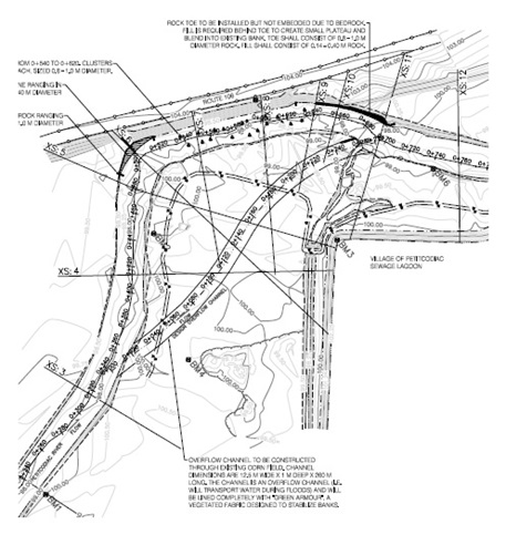
bank immediately upstream of the riprap on Route 106 and another portion of the left bank immediately downstream of it, as well as placement of boulder clusters within the river channel (the black triangles in Figure 25). These boulder clusters are intended to slow movement of water along the base of the rip rap armoured bank and create sheltered instream habitat there for fish.
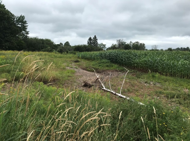
The high armoured bank creates a choke point in the river along this curve between Route 106 on the left bank and the Village of Petitcodiac Sewage Lagoon on the right bank. When the river floods, particularly during the spring freshet, it threatens to undermine or even potentially flood the lagoon. The purpose of the overflow channel through the field below would be to mitigate this, by preventing water from backing up by moving it more efficiently through this portion of the river. Though this channel wasn’t built in 2015 when the project was done, the river has been working at creating such a feature on its own. As can be seen four years later in 2019 (Figure 26) the river is working on creating a side channel through the field, which if it is successful may eventually turn this area into an island.
The stabilization of the portion of bank upstream of Route 106 that was done in 2015 is shown in Figure 27 in a series of repeat photographs taken of the site between 2016 and 2019. Unfortunately there is no before photo from 2015. Several things are apparent, however. On the one hand the large woody vegetation that was planted some distance back from the edge in 2015 was thinning out by 2017, difficult to find by 2018, and essentially gone by 2019. While that is unfortunate, the grasses which may have contributed to choking that woody vegetation out have themselves become well established on the site based on a comparison of the site being essentially bare in April of 2016 and yet consistently and increasingly thickly vegetated over the following years. This grass at least appears to be doing a good job of holding the bank together on its own. In depth, ongoing monitoring of this site was not undertaken by Fort Folly Habitat Recovery resource constraints and the fact it was a Petitcodiac Watershed Alliance project.


