Second Level Assessment- Current Impacts
Forestry Practices
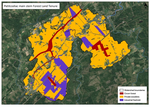
Forests cover 80% of the area within the portions of the Petitcodiac watershed along the main stem (the O’Blenis Composite and the Bannister Composite). Modern land tenure is a mixture of private woodlots crown land and industrial freehold subject to varying levels of management in terms of harvesting planting and thinning (Department of Natural Resources in 2023). This portion of the watershed (Figure 5) covers 115.2 km², of which private woodlots are: 67.9 km² (59%), Crown forests: 2.7 km² (2.3%), industrial freehold 23 km² (20 %). This is a mid-range as a proportion of Industrial Freehold compared to other nearby areas, ranked in descending order as follows: Anagance 57.35%; Memramcook 32.7%; Pollett 25.84%; North 12.77%; Demoiselle Creek 9.63%; Little 0.93%. Most forested land here is privately owned.