Third Level Assessment – Aquatic and Riparian Habitat Assessment
Primary Geomorphic Processes
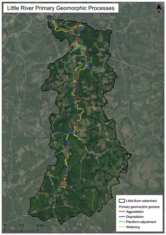
The primary geomorphic process identified on the assessed reaches of the Little River are shown in Figure 13. There were only slight differences calculated when comparing percentages based upon individual reaches to overall number of reaches or length of the assessed channel to individual reach lengths. These results indicate that widening is the primary geomorphic process occurring in 46% of the assessed length of the river (45% of reaches). This was the most common of all the primary geomorphic processes identified in each of the 123 reaches along the Little River (15 on Proser Brook, 5 on the East Branch of the Little River and 103 along the Little River main stem down to its confluence with the Petitcodiac). Channel aggradation drives conditions in 32% percent of these reaches while degradation was identified as the primary geomorphic process in 17% of the reaches, and planform adjustment dominates 5% of them (Figure 14).