Fourth Level Assessment – Aquatic Habitat Rehabilitation Plan
DTI Culvert Replacement
Route 126 over the North River in Maple Hills, DTI (2019): N 46.152440 W -64.927703
The Department of Transport and Infrastructure (DTI) undertook this project not because it was planned, but instead because the culvert failed and forced replacement to allow use of Route 126 (Figure 16a). The failure in 2019 was dramatic. It generated a plume of turbidity visible in the river roughly 70 km downstream on the main stem of the Petitcodiac at the Fish Net Trap that Fort Folly Habitat Recovery operates within the head-of-tide at Highland Park in Salisbury . The culvert was one that there had been awareness of for some time. FFHR noted it as needing attention in 2012 in the first edition of this North River Stewardship Plan. At the time – looking through the culvert it appeared from the inflow as if the pipe might be collapsing (Figure 16b: left). The outflow (Figure 16b: right) was perched (likely making it impassable).
In 2016 the Peticodiac Watershed Alliance assessed this culvert as part of their Broken Brooks Project (Culvert C-140 ) and determined that it was a full barrier to fish passage (Figure 6) due to being perched such that the outflow was elevated above the plunge pool (Figure 16b: right) limited access for fish attempting to move upstream beyond that point.
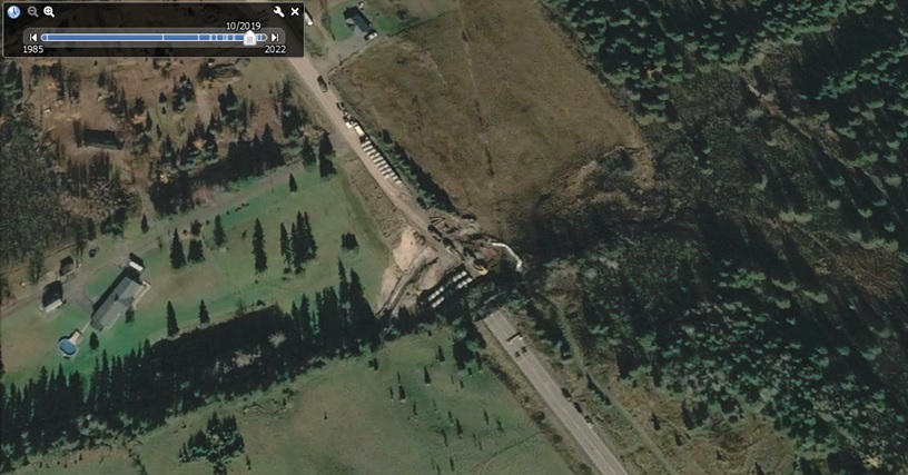

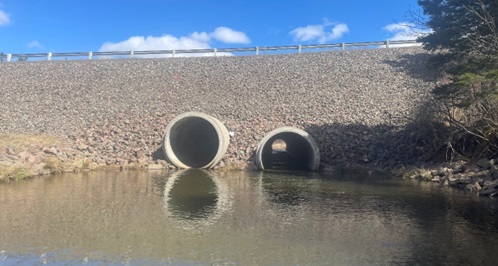
Figure 17 shows the rebuilt crossing in 2024. The new water-crossing is built out of concrete, with culverts that are each larger diameter than the original single corrugated steel culvert was. One of the two is low enough to allow fish passage, and the presence of the second helps better accommodate stormflow during extreme events.