Second Level Assessment- Current Impacts
Modern Forestry
Forestry Practices
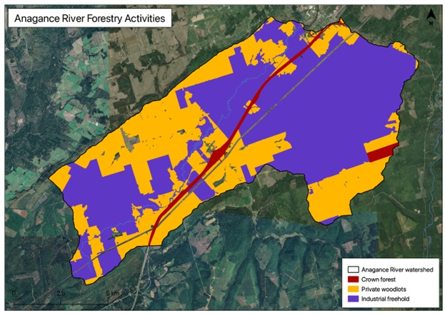
Forest tenure within the Anagance River watershed today is a mixture of private woodlots, industrial freehold, and crown land, which are subject to varying levels of management in terms of harvesting planting and thinning (Department of Natural Resources in 2014). The watershed (Figure 4) covers 138.87 km², of which private woodlots are: 58.42 km² (42.31%), Crown forests: 0.81 km² (0.59%), Industrial freehold leases: 79.64 km² (57.69%). Considering that 99% of the Anagance is forested, that translates to 57.35% of the basin being industrial freehold (J.D. Irving), the greatest proportion of any tributary in industrial hands. Industrial freehold in other tributaries rank in descending order as follows: Pollett 25.84%; North 12.77%; Demoiselle Creek 9.63%; Little 0.93%.
Hayward Brook and Holmes Brook drain much of the Industrial Freehold south of Highway 1 in the eastern portion of the watershed. These have been the focus of numerous studies by Environment Canada and J.D. Irving in collaboration with the Fundy Model Forest, L’Université de Moncton, and the University of New Brunswick to gauge the effects of forestry on aquatic ecosystems (Chaisson 1996; Pugh 1999; Pomeroy 2002)