Second Level Assessment- Current Impacts
Modern Agriculture
Agricultural Practices
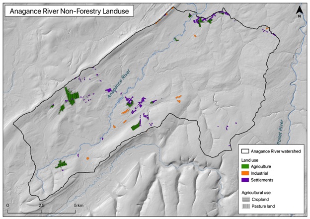
Today the Anagance watershed is sparsely populated with little agricultural development. Though minor (1% of the watershed), agriculture is the dominant non-forest land use within the Anagance River watershed (Department of Natural Resources in 2014). Of the 1.59 km2 of land being used agriculturally today, pastures account for 1.25 km2 (79%) of it; and grains were the remaining 0.33 km2 (21%). These are located either near settled areas such as the Village of Petitcodiac, Anagance, or near the ridge dividing between the Anagance and Jordan Brook (Kennebecasis). There are no cultivated blueberry fields within the watershed, which is somewhat unusual given how common these are within other Petitcodiac tributaries.