Second Level Assessment- Current Impacts
Modern Forestry
Forestry Practices
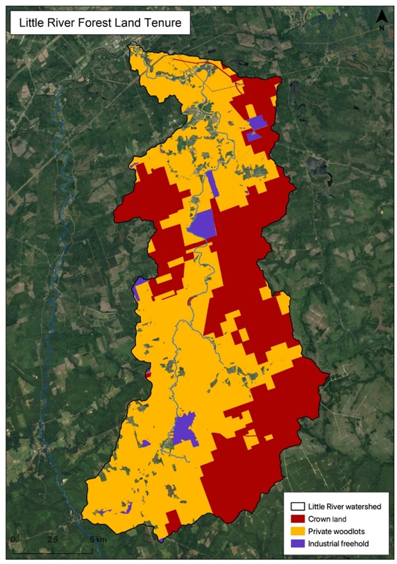
Forest tenure within the Little River watershed is a mixture of private woodlots, industrial freehold, and crown land, which are subject to varying levels of management in terms of harvesting planting and thinning (Figure 3). Forests cover 89% of the watershed (New Brunswick Department of Natural Resources in 2023). Unlike the Pollett (the next watershed over to the west) where the proportion of private woodlots increases along a gradient from the headwaters downstream towards its mouth, on the Little River private woodlots are common throughout. Private woodlots account for 58% of the forested area of the watershed, dominating the west, and making up much of the eastern half. Crown forests make up most of the rest at 41% of the forested area, primarily in the eastern half of the watershed. Industrial freehold forest lands account for about 1% of the forested area of the watershed, scattered throughout.
Maple syrup production remains a significant activity in the area. In addition to small scale private production there is a large commercial operation, Briggs Maples, tapping over 12,000 sugar maple trees in Albert County on both private and crown land near Fundy National Park (Briggs Maples 2015), with distribution through both Sobeys and CO-OP Atlantic.