Fourth Level Assessment – Aquatic Habitat Rehabilitation Plan
FFHR Dump Site Clean Up
Taylor Road, FFHR (2021-2023): N 46.086246 W -65.059693
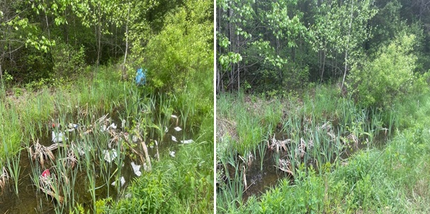
While a single site was identified for the purpose of locating this activity in Figure 15, in actuality, the entire length of the Taylor Road seems to serve as an illegal dump site. Garbage was not limited to one specific area, but instead distributed along the entire road in its ditches. (Figure 18). This area was repeatedly suggested by members of the local community on Facebook as an active dump site, when FFHR began its dumpsites clean up in 2021.


